- Itinerary
- Posto Florestal dos Prazeres - Fajã da Ovelha - Lombada dos Marinheiros
- Start
- Posto Florestal dos Prazeres (E.R. 210)
- End
- Lombada dos Marinheiros (E.R. 101)


With Funchal as reference:
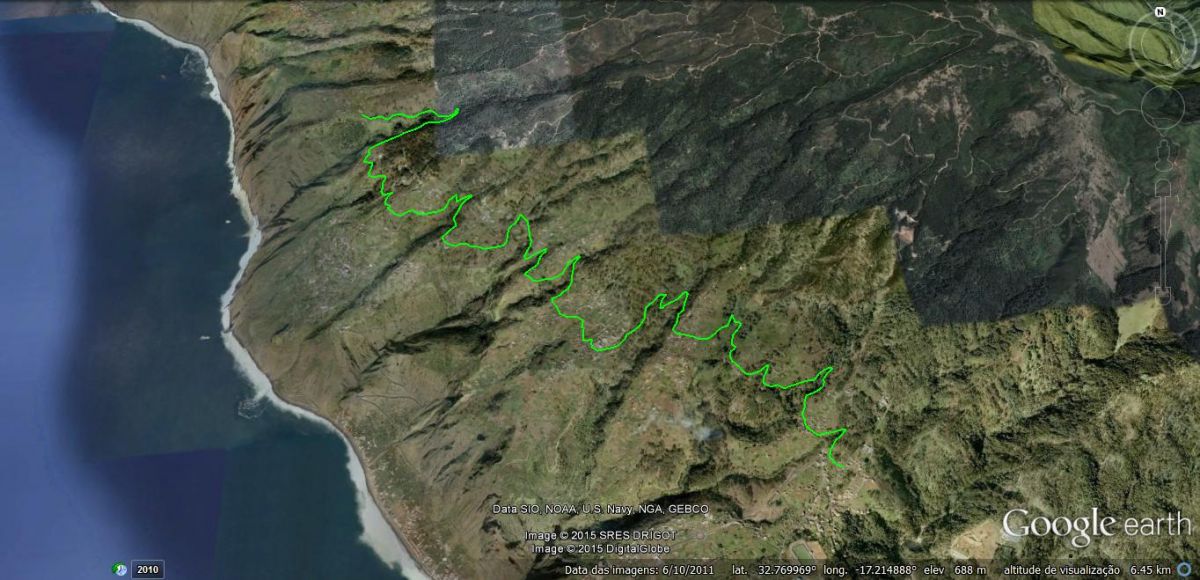
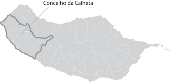
Stretching over 40km, Levada Nova da Calheta is the longest route of its kind in the Municipality of Calheta. While lengthy, altitude wise there isn’t much variation, with the levada flowing between 600 and 700 meters altitude.
This walk is used by many Madeirans trying to keep in shape and with the exception of Arco da Calheta, the aqueduct flows through all the Civil Parishes of the Municipality, meaning that there are numerous points of access.
Although Arco da Calheta may not receive water from this particular Levada, it has its own called Levada Nova do Arco da Calheta. Opened in April 2015 it is the continuation of the Levada Nova da Calheta project. Click here to have a look at Levada Nova do Arco da Calheta.
If you were to travel via the regional roads between Calheta, Estreito da Calheta, Prazeres, Fajã da Ovelha and Ponta do Pargo, at the altitudes indicated above, you would cross various times with this Levada, giving you a sense of just how big it really is.
So, if you do not wish to do this walk in its entirety, due to whatever reason, you could always do it in segments thus getting a feel for this agricultural levada walk.
We recommended this 12km portion of the Levada, starting in the civil parish of Prazeres it heads over to Lombada dos Marinheiros (Fajã da Ovelha). Keep in mind that if you decide to turn back to the starting point in Prazeres it’s another 12km, making your walk 24km which is approximately 7 to 8 hours walking.
The scenery you’ll find at any one of the possible sections is representative of the Levada as a whole. You’ll find large trees such as Pines and Eucalyptus, once serving as a means of rapid reforestation, as well as housing and farm land. Along this route you’ll certainly cross many streams and tributaries such as Ribeiras da Calheta, Marinheiros, Moinhos, Seca, Funda and many more.
In these more humid areas it is possible to find species belonging to the Laurel Forest or Laurissilva, like Canary Laurels and the endemic Bay Trees.
You’ll also come across farmland where the main regional vegetables grown are potatoes, sweet potatoes and green beans. Fruits also flourish here, you’ll likely find fig, papaya, lemon and apple trees.
In addition to the safety guide the Municipality of Calheta prepared specifically for you, which you may find here, please note these more specific recommendations:
- Wear comfortable footwear appropriate for a walk of this length;
- Take enough food and drink for the duration of your walk.